Wednesday, May 1, 2013

Social Development

At the turn of the twenty-first century, over four-fifths of Ireland's housing units were owned by their residents. Comparatively speaking, Ireland has incredibly high rates of home ownership. As discussed in a previous post, however, Ireland's economy fell in 2008, and as a result, so did the prices of homes. Before the property bubble burst in this year, the prices of homes steadily increased, and there began to be a shortage of homes for Irish citizens (Boland, et al., n.d.). 

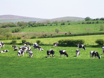
In terms of education, Ireland has similar characteristics to the United States. For example, primary school is free and mandatory, whereas secondary education includes private, community, and vocational schools. Students may receive university education at two major schools in Ireland, the University of Dublin, and the National University of Ireland. Both schools have campuses around the country, as education is highly valued for the citizens of Ireland. Though the country's world literacy ranking has fallen to seventeenth in 2010, the government still strives toward more efficient schooling methods in order to create a more successful, maintainable economy. 

By clicking here, we can even see the World Bank's development indicators for the country of Ireland. This information includes life expectancy, school enrollment, population, and GDP.

The following video is an NBC interview of a New York native who moved to Ireland two years ago, speaking on how the citizens of Ireland have reacted to the recent economic downturn. This video demonstrates how the economic status of a society can affect its residents' states of mind.


Sources

Boland, F., Edwards, R.W.D., Kay, S., Ranelagh, J. O., Abhinav, V., Albert, M., ... Young, G.  (n.d.).  Ireland.  Encyclopædia Britannica.  Retrieved from http://www.britannica.com/EBchecked/topic/293754/Ireland

Bridgetoofar2.  (2009, March 20).  Life in Ireland [video file].  Retrieved from http://www.youtube.com/watch?v=UKoVxm5QgaU

The World Bank.  (2013).  Ireland Data.  Retrieved from http://data.worldbank.org/country/ireland

Tuesday, April 30, 2013

Economic Development

Ireland is the home of a mixed economy. Though the country's constitution allows for private entrepreneurship, it also gives the government permission to provide "essential services" to the people (Boland et al., n.d.). Because of this, the state is involved in transportation, television, electricity, and health insurance. According to the 2013 Index of Economic Freedom, Ireland has an overall economic freedom score of 75.7 ("Ireland," 2013). The factors that contribute to this score include government spending, fiscal, business, and labor freedom, and freedom from corruption. The index considers Ireland as the eleventh freest country in the world. 

The 1990's were a golden time for Ireland. The country's high-technology sector boasted a relatively low corporate tax rate which allowed the economy to grow and unemployment to decrease to record-breaking levels. When this progress began to slow at the turn of the twenty-first century, the state turned to mortgage and construction companies to maintain a steady level of growth. This focus inflated these industries tremendously, without much capital to back this gain, and in 2008 they collapsed, leaving an intense economic recession their wake. In 2010, the European Union and International Monetary Fund bailed out the country, provided that Ireland complied with strict budgetary restrictions (Boland et al., n.d.). 

Agriculture is an important industry in Ireland's economy.

On a lighter note, agriculture remains a vital part in Ireland's economy. The country's rich agricultural land and ideal climate make Ireland an important farming country. From beef cattle to sheep raising to cereal growing, Ireland truly hosts a plethora of agricultural gold. Among the most successful output in the farming industry includes beef, farmhouse cheese, and bloodstock. 

Ireland does, however, lack a large supply of minerals. In fact, the country must depend almost entirely on imports for energy development. Almost all rural homes are "connected to the national electricity network, which relies partly on hydroelectric plants and on small and medium-sized peat-burning thermal power stations" (Boland et al., n.d.). 

The country is one of the world's top exporters of computer software. Ireland's chief trading partner is the United Kingdom, among other European Union nations. Other significant exports include textiles, food, and machinery. 

Ireland adopted the euro as its official currency in 1979.

In 1979, Ireland joined the European Monetary System, and in doing so, adopted the euro as its official currency. The two most important finance buildings in Ireland are the Central Bank of Ireland and the Irish Stock Exchange. Though the Central Bank does not perform any transactions with the public, it is responsible for overseeing the country's other financial buildings, including the Irish Stock Exchange. The Exchange is actually the oldest in the world; it has been in-use since 1793. 

Sources:


Boland, F., Edwards, R.W.D., Kay, S., Ranelagh, J. O., Abhinav, V., Albert, M., ... Young, G.  (n.d.).  Ireland.  Encyclopædia Britannica.  Retrieved from http://www.britannica.com/EBchecked/topic/293754/Ireland

Ireland.  (2013).  Retrieved from http://www.heritage.org/index/country/ireland


[Photograph of dairy cow field].  Retrieved from http://www.eolasmagazine.ie/where-now-for-irish-agriculture

Sunday, April 28, 2013

Geopolitical Framework


Ireland hosts a parliamentary democracy. The president serves a term of seven years, as elected by the people, and is considered the guardian of the country's constitution. The Parliament is known as the Oireachtas, and is divided into two houses. The first is the Dáil Éireann, or the House of Representatives, and the latter is the Seanad Éireann, or the Senate. Ireland's government also includes the prime minister, who holds executive power, the deputy prime minister, and the minister of finance.

Ireland Political Parties 1751

The Irish Parliament House

The country is divided into borough corporations and city councils. These elected councils are in charge of important policy decisions regarding taxes, bylaws, etc. whereas the city manager handles administrative duties.

In terms of justice, the President appoints all judges, who serve until death or retirement unless removed from office by the Oireachtas. There is a Supreme Court, as well as a High court and several circuit and district courts. In 1972, the country even established a special criminal court for cases involving terrorism. 

Equal gender representation in government is nonexistent in Ireland, but the country has elected two female presidents in the past:  Mary Robinson (1990) and Mary McAleese (1997). There have recently been calls for quotas in the Oireachtas so women can obtain more representation. 
There are four major political parties in Ireland. 

1. Fianna Fáil:  This Republican Party was founded by Eamon de Valera, a former prime minister and president of Ireland. This party is currently in power. It adopts centrist, pro-business policies, but lost some popularity after Ireland's property bubble burst.

2. Fine Gael:  This party of Irish nationalists founded the Irish Free State. This party was in power from 1922-1932. After World War II, the power tended to shift toward the Fianna Fáil. The Fine Gael has been out of power since 1987, but the distinctions between this parry and the Fianna Fáil have become increasingly blurred over the years.

3. The Labour Party:  This party used to be seen as a minor coalition, battling the oppression and hegemony of the Fianna Fáil and Fine Gael. For the first time in history, however, opinion polls place it ahead of these two major parties.

4. Sinn Féin:  This anti-big business party originally gained its popularity in Northern Ireland, but has begun to set its sights on the Republic for more political power.

Sources:

Boland, F., Edwards, R.W.D., Kay, S., Ranelagh, J. O., Abhinav, V., Albert, M., ... Young, G.  (n.d.).  Ireland.  Encyclopædia Britannica.  Retrieved from http://www.britannica.com/EBchecked/topic/293754/Ireland

Crowley, J.  (2010).  A Guide to Ireland's Political Parties.  Retrieved from http://blogs.wsj.com/dispatch/2010/11/23/a-guide-to-irelands-political-parties/

Toscano, J.  (n.d.).  [Photograph of Irish Parliament House].  Retrieved from http://www.nationsencyclopedia.com/Europe/Ireland-POLITICAL-PARTIES.html#b


Saturday, March 9, 2013

Cultural Coherence: Global Context

In 2010 Global Index, Ireland beat out Singapore for the number 2 spot of globalization. This index "measures and tracks the performance of the world’s 60 largest economies in relation to separate indicators in five broad categories: openness to trade; capital movements; exchange of technology and ideas; movement of labor; and cultural integration" (Hennigan, 2011). Ireland's score increase from 2009 to 2010 is the direct result of a larger movement of goods and services as a proportion of its GDP. In particular, the export of chemicals has increased in the country, contributing to this rise. Ireland also ranked number one in two of the five categories of this survey, exchange of technology and ideas, and movement of labor. Though their labor force is now decreasing as a result of lower migration, the country's number one spot in the first category stems from greater amounts of internet subscribers.

The country is expected to maintain a steady rise in globalization, and in 2014 it may top the list, surpassing Hong Kong, and reaching a trade level that is over 230% of GDP (trade now rests at around 200%). Tourism is also expected to increase up to 3,600 per 1,000 residents in 2014, as opposed to its current 3,400 per 1,000 residents. Below is the list of the results of this survey.

RankCountry / Territory2010 ScoreTradeCapitalTechnologyCultureLabour
1Hong Kong (SAR)7.489.787.915.879.254.57
2Ireland7.346.667.119.497.206.10
3Singapore6.789.556.165.588.114.37
4Denmark5.935.176.058.924.744.41
5Switzerland5.865.125.506.205.976.62
6Belgium5.826.216.446.674.634.81
7Sweden5.805.326.108.184.704.38
8Netherlands5.596.016.096.104.654.85
9Hungary5.356.065.225.874.924.48
10Finland5.294.935.607.354.313.98
11Slovakia5.166.004.833.896.414.83
12Taiwan5.155.725.136.044.124.43
13Israel5.114.845.226.385.183.83
14Austria5.105.505.395.565.253.70
15United Kingdom5.004.635.755.784.554.12


Source:

Hennigan, M.  (2011, January 26).  Globalization Index:  Hong Kong in top place; Ireland overtakes Singapore for second rank.  Finfacts.  Retrieved from http://www.finfacts.ie/irishfinancenews/article_1021487.shtml

Cultural Coherence: Language and Music

The Irish Flag.

The official language of Ireland is English, but a small percentage of native Irishmen and women speak Irish (Gaelic/Irish-Gaelic). This language originates from Ireland is a member of the Indo-European language family. It is considered an official language of the European nation and hold significant symbolic status for the country and its history.

FUN FACT: There is no definitive "yes" or "no"  in the Gaelic language.

As in any culture, Ireland's residents have particular ways of using this language which is unique to their society. They are known as eloquent, friendly speakers who value modesty and maintain a general distrust for those who tend to brag. Manners are significant while communicating to Irishmen and women, and acts such as giving firm handshakes, maintaining eye contact, and warmth are key in proper communication. Irish business-people are more informal and friendly than many other European countries, because they tend to offer more relaxed, comfortable settings. Overall, the culture appears to value politeness more than brutal honesty. Irishmen and women usually avoid conflict and confrontation, and prefer to communicate through humor and good nature. 

River Dance serves an important cultural function in Ireland.

Music also plays a key role in Irish culture. Traditional Irish music include the use of instruments such as the Irish drum, the fiddle, the flute, and the Uilleann pipes. Irish music tells stories through its melodies and lyrics, and because story-telling is an important aspect of Irish culture, music serves as an outlet for this communication. Popular music ranges from traditional to Celtic/Irish rock, and River Dance has become a significant form of dance throughout the country, possibly due to its fast pace and complexity.

The following video demonstrates traditional Irish music from a Celtic Fiddle Festival and some of the stunning scenery of the country.

Sources:

Kwintessential.  (n.d.).  Ireland - Language, Culture, Customs, and Etiquette.  Retrieved from http://www.kwintessential.co.uk/resources/global-etiquette/ireland.html

Donnchadha, S.  (n.d.).  Music Culture in Ireland.  Retrieved from http://www.yourirish.com/culture/music/

Hendicott, J.  (n.d.).  Irish-flag.  Retrieved from http://hendicottwriting.com/travel/blog/ireland2/irish-flag-2/

Sundresslady.  (2012, May 8).  Music Session 1 [video file].  Retrieved from http://www.youtube.com/watch?v=hi9Ju_qz1Hk 

Weddington, F.  (2010, April 27).  [Riverdance].  Retrieved from http://cltampa.com/dailyloaf/archives/2010/04/27/do-it-today-riverdance-at-ruth-eckerd-free-std-testing-and-a-fresh-market#.UTvZERy1eAg


Population and Settlement: Urban Life

62% of Ireland's population rests in urban areas. According to the 2011 Census, almost all of the towns in the country continue to grow, with some growing at a very strong rate.Click here to see the current and past populations of Irish cities, and how the percentage of change between 2006 to 2011.

Children living in the Irish slums during the early 20th century.


Actual urban life has changed immensely in the last century. In the early 1900's, poor families were often found crammed into small tenements in large cities, which lacked proper water, sewage, and electricity. Dublin, now the largest city in terms of population in the country, has some of the worst slums in all of Europe during this time. Dublin's formerly elite, luxurious great Georgian terrace homes housed over 21,000 cramped families throughout the 1920's. Work was sparse and far between for many citizens; men were usually found doing work on the docks, waiting for long-term employment while women worked in social services and factories. It wasn't until the 1940's that the cities began to grow and develop in a more positive light.

Irish docks in the 1900's and 2010.

After the Anglo-Irish Treaty was signed, which established the Irish Free State, leaders of Ireland began to do more in terms of public planning. The first major shift in urban living was the destruction of tenement housing. The 1960's began a shift to suburban towns, such as Marino and Crumlin, which sit on the outer edges of big cities. This shift brought about mixed results. Though they were successful in destroying the majority of tenements, there was so much pressure to get the suburban homes ready that they became somewhat makeshift due to limited planning. Because of the lack of markets, transportation, and jobs nearby, for a period of time these suburbs were also synonymous with drug abuse, crime, and unemployment.

After the economic boom of the 1990's, however, life became easier in the urban setting for the Irish peoples. In October of 1985, shortly before the boom, Urban Renewal Projects were introduced to the major cities of Ireland that were facing severe dilapidation.


Henry Street, Dublin in the 1900's and now.

Today, Dublin is considered one of the most vibrant, exciting cities in Europe. The city continues to rapidly grow each year, currently housing about 1.6 million residents, and is home to some of the most influential authors of history, including Oscar Wilde and Samuel Beckett. The city brims with historical architecture from the Georgian period and style, and displays its history through its museums, theaters, and and castles. Though it was once known as home to the worst slums in the continent, Dublin is now an example of the long, rich history Ireland boasts.

Sources:

Getty Images.  (n.d.).  Poor Dublin Ancestors.  Retrieved from http://www.whodoyouthinkyouaremagazine.com/take-it-further/overseas/poor-dublin-ancestors

Ireland after NAMA.  (2012, April 27).  Census 2011:  Town and Country Data.  [Blog post].  Retrieved from http://irelandafternama.wordpress.com/tag/census-2011/

Look Around Ireland.  (2011).  Dublin Ireland.  Retrieved from http://www.lookaroundireland.com/city/dublin.htm#

Socyberty.  (2011).  Social Change in Ireland:  Urban Life.  Retrieved from http://socyberty.com/society/social-change-in-ireland-urban-life/

Taxi, M.  (n.d.).  [Photograph of Irish docks in the 1900's and present day].  Retrieved from http://www.dublin.ie/forums/showthread.php?10697-Then-and-Now-photos-of-Dublin/page2

Population and Settlement: Migration and Diversity

The current population of Ireland rests around 4.7 million people. After a huge economic boom in the 1990's, the net emigration of Ireland increased to the point that the government created new laws and criteria for welcoming immigrants. There were three major policy areas that influenced the influx of immigrants and the current population of the country. First, the country created a list of acceptable home countries, and then prioritized these immigrants. Next, between 2003 and 2005, the country eliminated the law that an Irish-born child automatically becomes a citizen, even if his or her parents are foreign-born. The third policy change involved meeting the needs of the lower-skilled workers who immigrated to the country. 

The biggest influence on the increased population of the country stemmed from an agreement that Ireland made that accepted immigrants from other countries in the European Union immediately to start work that corresponded with each immigrant's skill level.

The population spikes after the 1990's.

Currently, Ireland has stricter policies in regard to immigration, favoring highly skilled workers who are not necessarily from countries within the European Union. Because of the current economic recession the country faces, there has been a decline in immigration, though the rate remains a relatively large number, and a lack of jobs for legal foreign citizens and Irish nationals alike.

Among the current 4.7 million residents in the country lies some diversity. The country's demographics consist of an Irish majority (roughly 87% of the population). The remaining 13% includes Asian at 1%, Black at 1%, other White at 8%, and mixed or unspecified at about 3%. This distribution of race is primarily the result of Ireland's policy changes, as discussed earlier, in deciding who to accept into the country and the preference of admitting immigrants from the Euorpean Union. 

Most of the population rests between the ages of 15 and 64 years old, with the median age being about 35. The population continues to grow at a rate of 1.112% per year, as of 2011, with a birth rate of about 15.81 per 1,000 population and a death rate of 6.38 per 1,000 population. The life expectancy is about 80 years old for men and women and the country's obesity rate rests at 13%, less than half of the United States' (35%).


Sources:

CSO.  (n.d.).  Republic of Ireland Population 1926-2011.  Retrieved from http://www.epa.ie/irelandsenvironment/environmentalindicatorsdashboard/population/

Index Mundi.  (2012).  Ireland Demographics Profile 2012.  Retrieved from http://www.indexmundi.com/ireland/demographics_profile.html

Migration Information Source.  (2013).  Ireland:  From Rapid Immigration to Recession.  Retrieved from http://www.migrationinformation.org/Feature/display.cfm?ID=740


Environmental Geography: Mountains and Water Systems

Hikers trek through an Irish mountainside.


Ireland is home to two of the great mountain systems in Europe:  the Caledonian and the Armorican. The Caledonian system runs through the north-western portion of the country, with its highest mountains made of quartzite, which creates narrow, cone-shaped peaks. The Armorican range is younger, and extends through the southern portion of Ireland. One of its mountains, Carrantouhill in the Magillycuddy Reeks, holds the record for being the highest peak in the country, topping off at 1041 meters (about 3415 feet).

These two major mountain systems surround the heart of Ireland, a limestone-floored lowland that opens to the Irish Sea on the east and the Atlantic Ocean on the west through numerous bays. This lowland, however, is not completely flat. It is broken up by hills, which continue to rise toward the west until their abrupt termination at the Cliffs of Moher, which are known as some of the most beautiful cliffs in Western Europe. The header image of this blog is, in fact, a picture of these cliffs.

River Shannon


As for water in the country, River Shannon wins the title for the largest river in the country, running 340 kilometers (roughly 211 miles)  in length. This river is home to the country's earliest hydro-electric power scheme, and at its center River Shannon broadens into multiple beautiful and popular lakes.

The second largest river in the country is the Barrow River. This river runs roughly 69 kilometers (42 miles), which still pales in comparison to the country's largest river. It streams through major towns like Carlow Town and Bagenalstown, and is known primarily as a coarse angling river.

The River Slaney is often considered the best river for salmon fishing in  the country. It extends south from Lugnaquillia Mountain in County Wicklow to the Wexford Harbor, which served as a key shipping center during the 19th century. This river only spans about 117 kilometers (73 miles), a fraction compared to the massive River Shannon.

Sources:

Green, M.  (2013).  An Outline Geography of Ireland.  Retrieved from http://www.ireland-information.com/reference/geog.html#PHY

Lodged, L.  (2010).  River Shannon from Drumsna Bridge.  Retrieved from http://commons.wikimedia.org/wiki/File:River_Shannon_from_Drumsna_bridge.jpg

River Slaney.  (n.d.).  In Encyclopædia Britannica online.  Retrieved from http://www.britannica.com/EBchecked/topic/548054/River-Slaney

Visitravel, Ltd.  (2010).  Rivers in Ireland.  Retrieved from http://blog.goireland.com/2010/01/19/rivers-in-ireland/#axzz2N3yOcGef

Wang, C.  (2013).  Hiking in Ireland.  Retrieved from http://www.prattlibrary.org/booksmedia/blog/prattchat.aspx?id=78343&blogid=12298#.UTmIGTC1eAg

Environmental Geography: Concerns


The greenery of Ireland that allures visitors is in peril.

Though Ireland has a forgiving environment, the country faces numerous environmental concerns. According to the EPA, who releases a report every year that discusses the state of Ireland's environment, the air and water pollution, littering, and poor waste management have become major concerns. A recent survey stated that 35% of groundwater samples showed fecal contamination from nearby farms. On a more positive note, 85% of lakes and 70% of lakes and rivers (respectively) were in good condition. Nevertheless, water quality and pollution are two environmental concerns that the Irish government has been taking steps to reduce such issues through taxation, recycling programs, and sustainable farming programs.

In a 2012 survey compiled by Germanwatch and Climate Action Network Europe, Ireland was ranked 9th in how well they are combating global warming. This puts the country eight spots ahead of their previous 17th ranking in 2011. The economic decline is a factor contributing to Ireland's higher score, because the deflation of the economy and job loss has significantly cut the country's CO2 emissions. The organizations in charge of this survey advise against any restarting of the economy because this will only lead to more emissions, unless further steps are put into place to create government policies that encourage energy efficiency.

Though they have leaped up on this survey, Ireland is still experiencing some of the results of poor environmental maintenance. The country's average temperature has been increasing at a rate of 0.8 degrees Farenheit per decade since the 1980's, which is faster than the averages of the other countries in the world. In the future, this will most likely cause a much drier climate in the inlands and put the country's largest crop, the potato, in danger. The fish population may become endangered, and the signature greenery of Ireland will begin to brown.

The climate change in the country may lead to an uneven distribution of water and rainfall in the country, slashing the residents' current access to water. At the same time, the coast continues to gobble up about 750 acres of the island each year, increasing the risk of widespread and long-lasting flooding. These effects will continue to culminate, especially if Ireland's economy begins to grow after its last downturn. In response to these issues, the Irish government has pledged to reduce its emissions by 20 percent. Only time will tell if these promises are kept and if the government can, in fact, save the country. 

Sources:

McCormack, G.  (n.d.).  SLG 139.  Retrieved from http://www.garethmccormack.com/stock/image/visitors-admiring-glencar-waterfall-co-sligo-irela/

McDonald, F.  (2012, December 4).  State improves performance on global warming.  The Irish Times.  Retrieved from http://www.irishtimes.com/news/state-improves-performance-on-global-warming-1.786

Scott, S.  (2009).  Environmental Concerns.  Retrieved from http://www.movetoireland.com/movepag/miscenvr.htm

The Select Committee on Energy Independence and Global Warming.  (n.d.).  Keeping the Emerald Isle Green.  Retrieved from http://globalwarming.markey.house.gov/impactzones/ireland.html

Environmental Geography: Landform and Climate

Physical Map of Ireland.

Ireland is an island located to the west of Great Britain. It is the third largest island in Europe, making it the twentieth largest island in the entire world. In 1921, the country was split into two parts:  Northern Ireland, which is a part of the United Kingdom, and the independent Ireland, which contains 26 counties.

The Irish Sea separates Ireland from Great Britain on the east coast. On the west coast, the country terminates at the Atlantic Ocean.

As a result of two major glaciations, the island of Ireland contains many mountain lakes, ice-smoothed rocks, and deposits of glacial rocks and sand.

The country boasts a temperate climate, giving its residents cool winters and mild summers, a result of the warm ocean waters Ireland receives from the North Atlantic Drift.  Th coldest months of the year are January and February, with average temperatures between 4 and 7 degrees Celsius (39 to 44 degrees Farenheit). On the other end of the spectrum, July and August boast the warmest months, with average temperatures of 14 to 16 degrees Celsius (57 to 60 degrees Farenheit).

Rain is quite common all year-round, especially on the westward facing slopes. This feature is the direct cause of the country's intense greenery. The country also lacks many trees, which is the result of the strong winds that inhibit growth.

Ireland also includes numerous islands surrounding its coasts. The largest of these islands is Achill, which is considered by tourists to be an unspoiled paradise. It is known as a place of peace and solitude, with beautiful beaches and many popular water sports. The video demonstrates the utter beauty of this island.


Sources:

Green, M.  (2013).  An Outline Geography of Ireland.  Retrieved from http://www.ireland-information.com/reference/geog.html#PHY

Green, M. (2013).  Land and People - Physical Features and Climate.  Retrieved from http://www.ireland-information.com/reference/physical.html

Mayo Ireland.  (2010).  Achill Island.  Retrieved from http://www.achill.com/

Mccan, P.  [tittlethepipes].  (2009, April 7).  Sunlit Streams [video file].  Retrieved from http://www.youtube.com/watch?feature=player_embedded&v=itEKGFzWigA#!

Vidiani.com.  n.d..  General Map of Ireland.  Retrieved from http://www.vidiani.com/?p=2339