 |
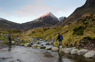
Hikers trek through an Irish mountainside. |
Ireland is home to two of the great mountain systems in Europe: the Caledonian and the Armorican. The Caledonian system runs through the north-western portion of the country, with its highest mountains made of quartzite, which creates narrow, cone-shaped peaks. The Armorican range is younger, and extends through the southern portion of Ireland. One of its mountains, Carrantouhill in the Magillycuddy Reeks, holds the record for being the highest peak in the country, topping off at 1041 meters (about 3415 feet).
These two major mountain systems surround the
heart of Ireland, a limestone-floored lowland that opens to the Irish Sea on
the east and the Atlantic Ocean on the west through numerous bays. This
lowland, however, is not completely flat. It is broken up by hills, which
continue to rise toward the west until their abrupt termination at the Cliffs
of Moher, which are known as some of the most beautiful cliffs in Western
Europe. The header image of this blog is, in fact, a picture of these cliffs.
 |
River Shannon |
As for water in the country, River Shannon wins the title for the largest river in the country, running 340 kilometers (roughly 211 miles) in length. This river is home to the country's earliest hydro-electric power scheme, and at its center River Shannon broadens into multiple beautiful and popular lakes.
The second largest river in the country is the
Barrow River. This river runs roughly 69 kilometers (42 miles), which still
pales in comparison to the country's largest river. It streams through major
towns like Carlow Town and Bagenalstown, and is known primarily as a coarse
angling river.
The River Slaney is often considered the best
river for salmon fishing in the country. It extends south from
Lugnaquillia Mountain in County Wicklow to the Wexford Harbor, which served as
a key shipping center during the 19th century. This river only spans about 117
kilometers (73 miles), a fraction compared to the massive River Shannon.
Sources:
Green, M. (2013). An Outline
Geography of Ireland. Retrieved from http://www.ireland-information.com/reference/geog.html#PHY
Lodged, L. (2010). River Shannon from Drumsna
Bridge. Retrieved from
http://commons.wikimedia.org/wiki/File:River_Shannon_from_Drumsna_bridge.jpg
River Slaney. (n.d.). In Encyclopædia Britannica online.
Retrieved from
http://www.britannica.com/EBchecked/topic/548054/River-Slaney
Visitravel, Ltd. (2010). Rivers in
Ireland. Retrieved from
http://blog.goireland.com/2010/01/19/rivers-in-ireland/#axzz2N3yOcGef
Wang, C. (2013). Hiking in Ireland. Retrieved
from
http://www.prattlibrary.org/booksmedia/blog/prattchat.aspx?id=78343&blogid=12298#.UTmIGTC1eAg
No comments:
Post a Comment